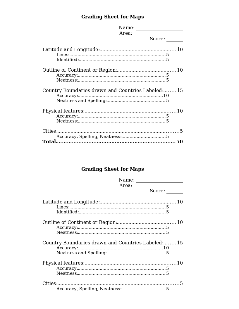
This grading rubric is to be filled out by the teacher to grade each student on part of the final map project. It grades latitude and longitude, outline of continent, country boundaries drawn and labeled, physical features and...
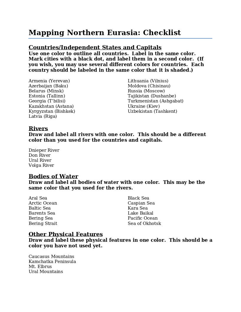
Instructions for drawing and coloring a map of Northern Eurasia. Includes a list of the countries, independent states, capital cities, physical features, rivers and bodies of water that are to be located on the map.
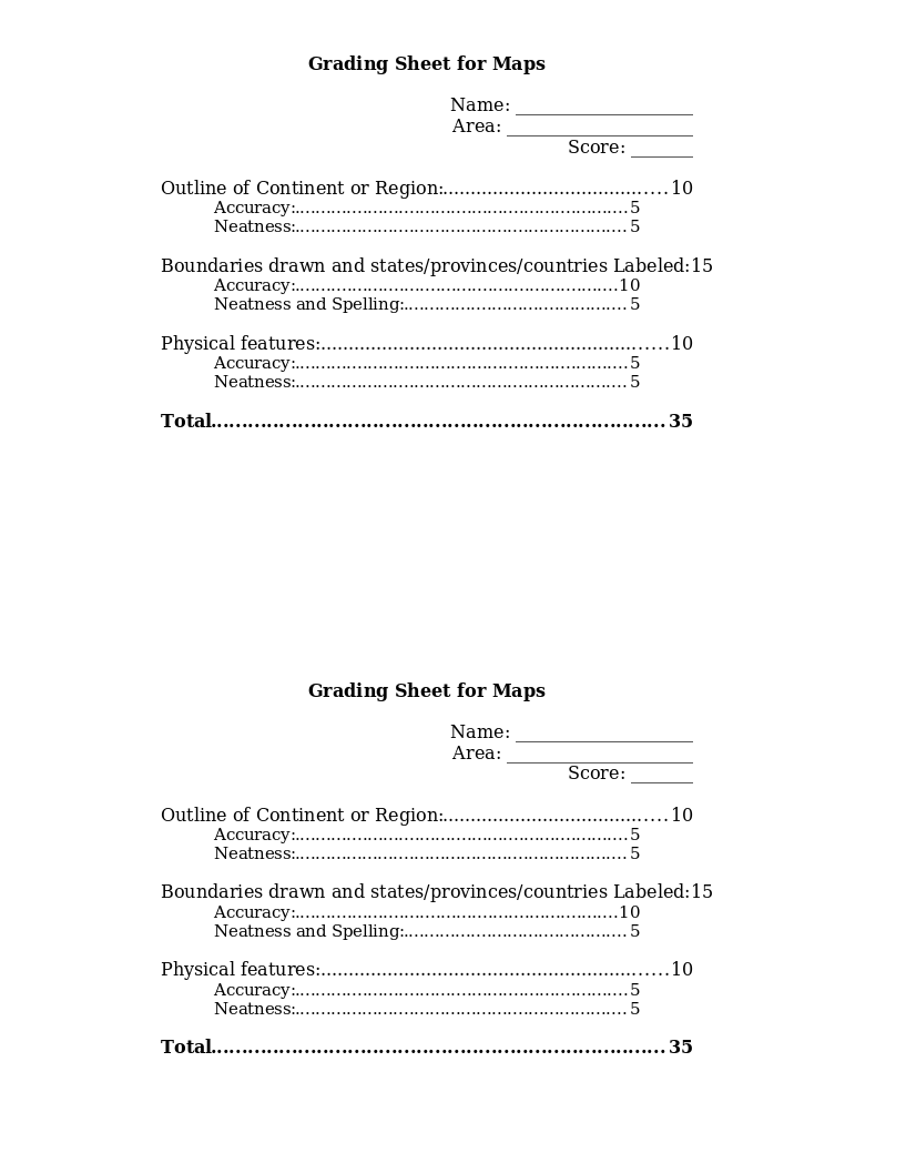
This grading rubric is to be filled out by the teacher to grade each student on part of the final map project. It grades outline of continent, country/state/province boundaries drawn and labeled and physical features for a total...
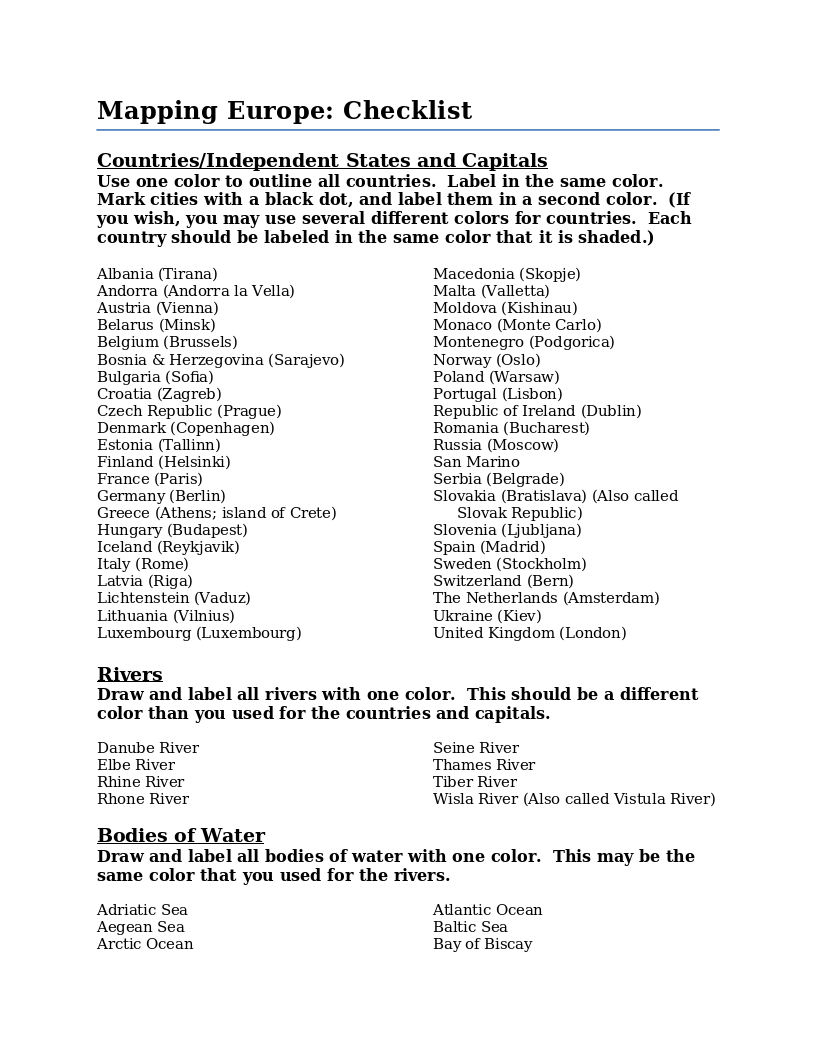
Instructions for drawing and coloring a map of Europe. Includes a list of the countries, independent states, capital cities, physical features, rivers and bodies of water that are to be located on the map.
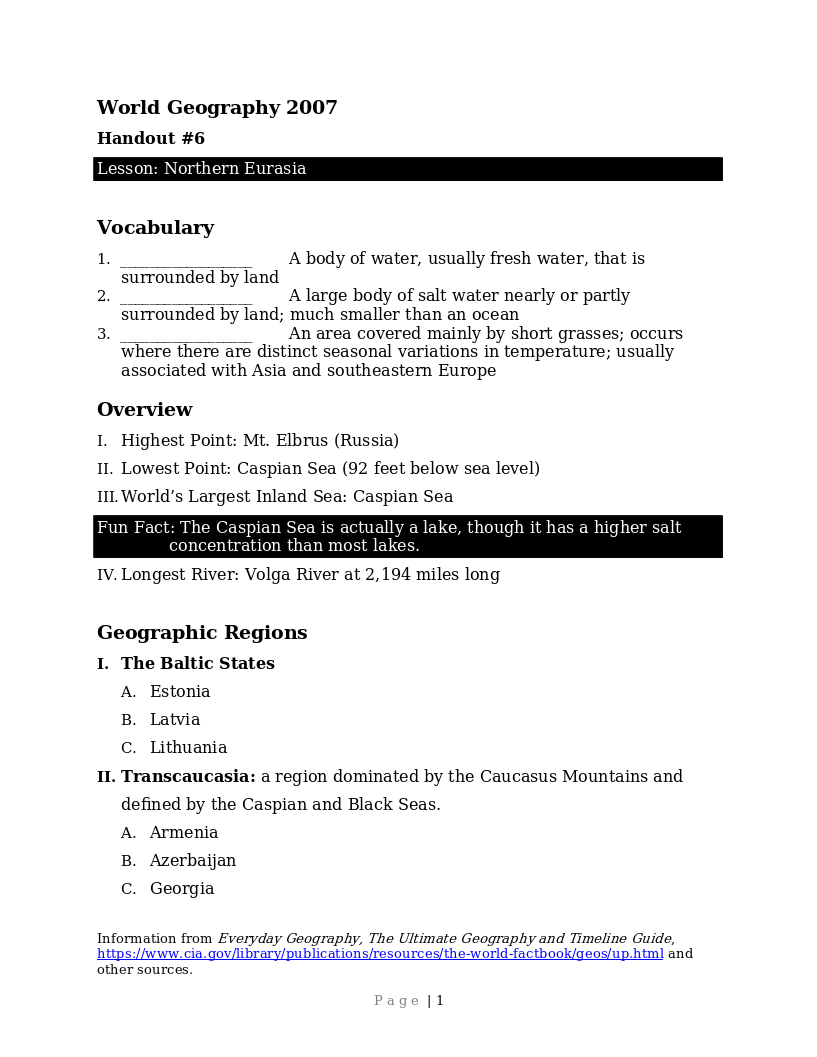
Student handout to go with the lessons on Northern Eurasia. It includes an overview of the area, its geographic regions, a brief history mainly from the 20th century, and the specific countries within the region.
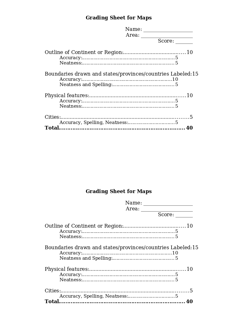
This grading rubric is to be filled out by the teacher to grade each student on part of the final map project. It grades outline of continent, country/state/province boundaries drawn and labeled, physical features, and cities for...
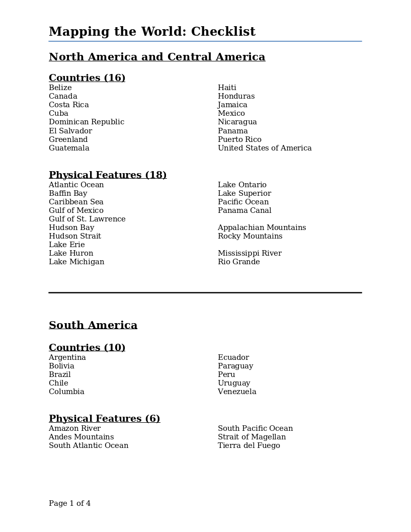
This checklist for the final project of drawing a world map lists the countries and physical features by continent that should be included in the maps drawn by each student.
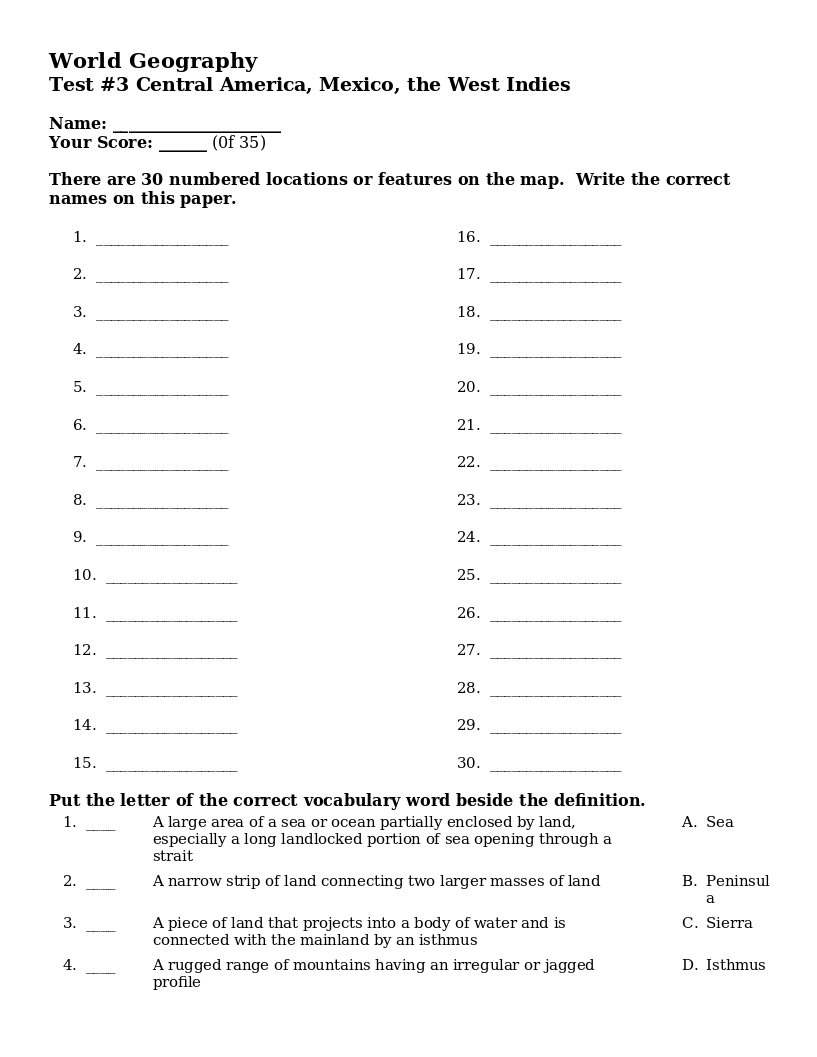
A test on Central America geography. With 30 numbered locations on the map, students are to write the correct names for each location. Includes 5 words to match to their definitions.
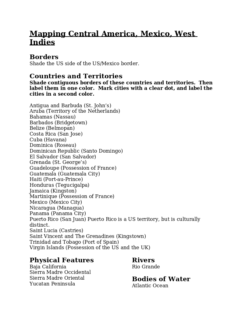
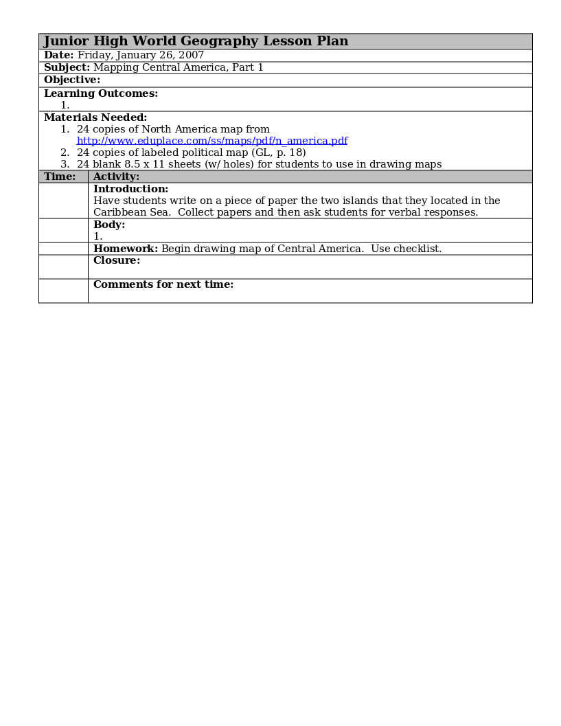
Instructions for drawing and coloring a map of Central America. Includes a list of the countries, territories, cities, physical features, rivers and bodies of water that are to be located on the map.
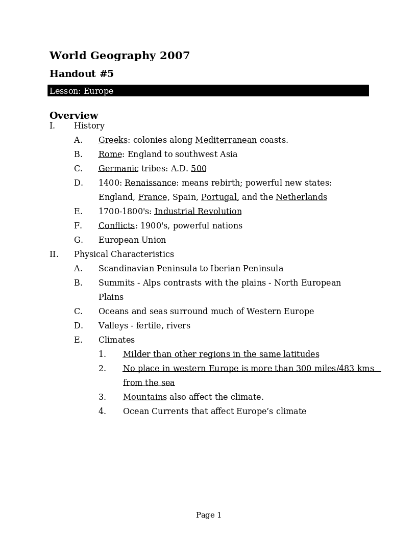
A brief overview of the history, physical characteristics, people and cultures of Europe. Each country is named with some countries having additional history or physical features mentioned.
Some pictures of student-drawn maps for the final map drawing project in World Geography. Click on an image for the full-size file. Central America South America Europe