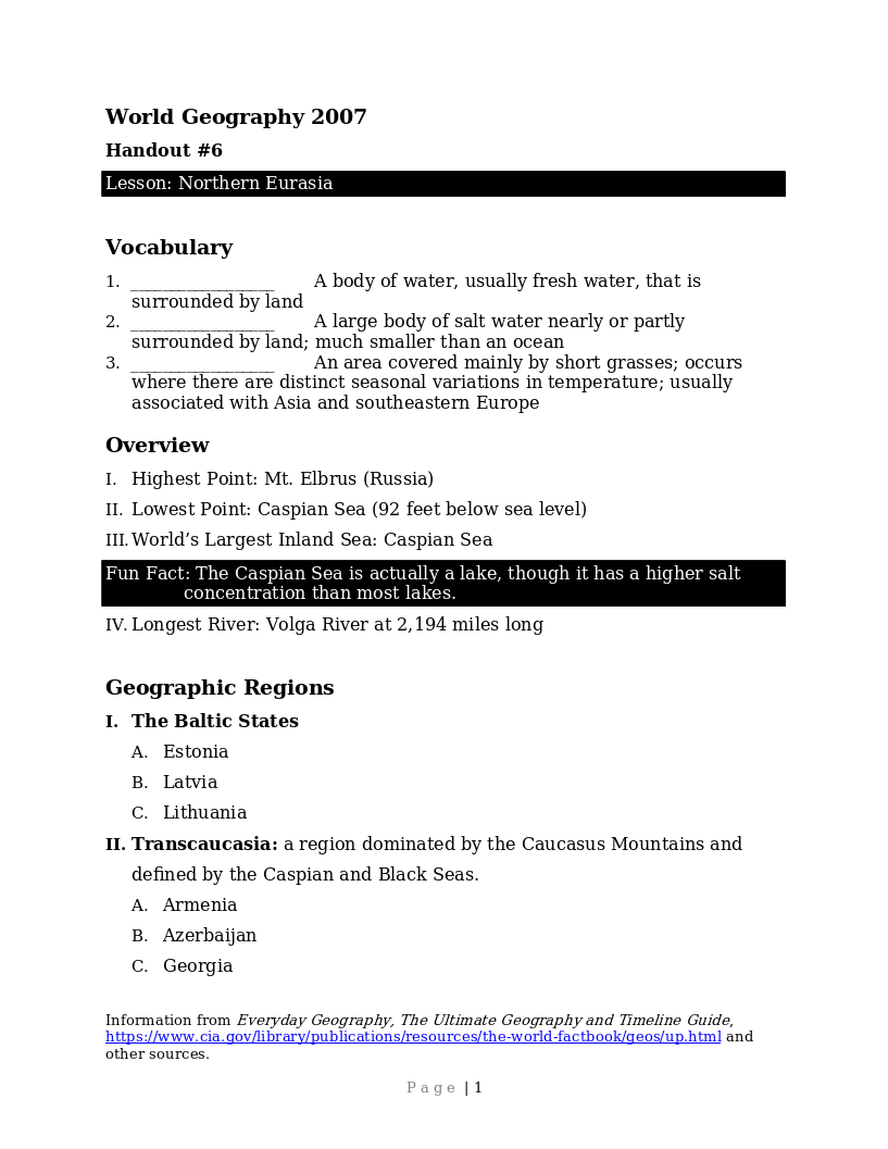
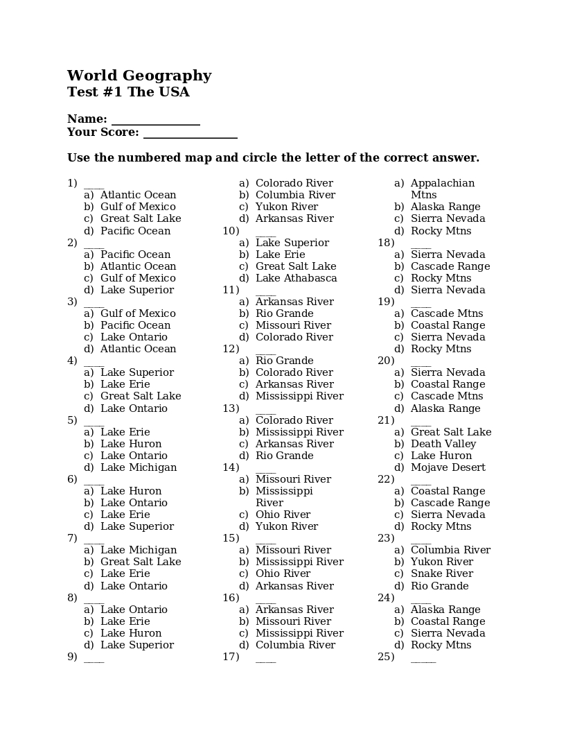
Student handout to go with the lessons on Northern Eurasia. It includes an overview of the area, its geographic regions, a brief history mainly from the 20th century, and the specific countries within the region.
A syllabus for Life Science taught in grades 7-9. Textbooks used are Life Science and Student Activities in Life Science, both Second Edition, Bob Jones University Press.
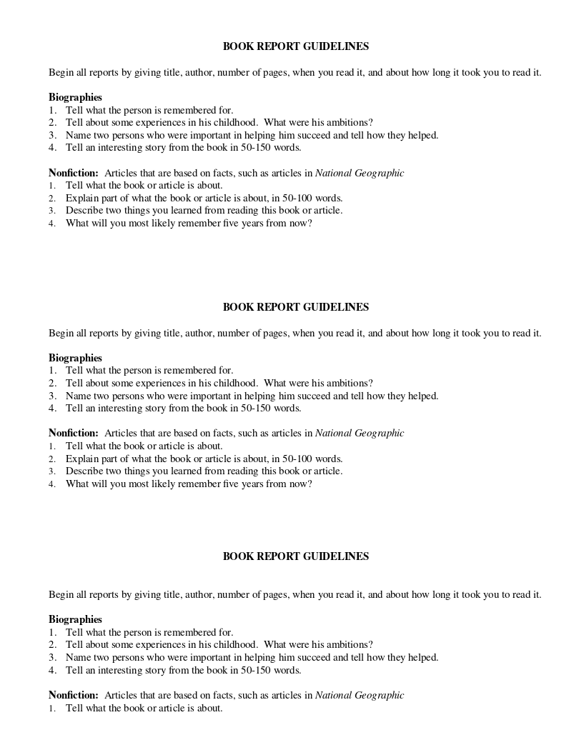
Student handout giving instructions for a book report. Clarification is given whether doing a report about a biography, a non-fiction book or an article.
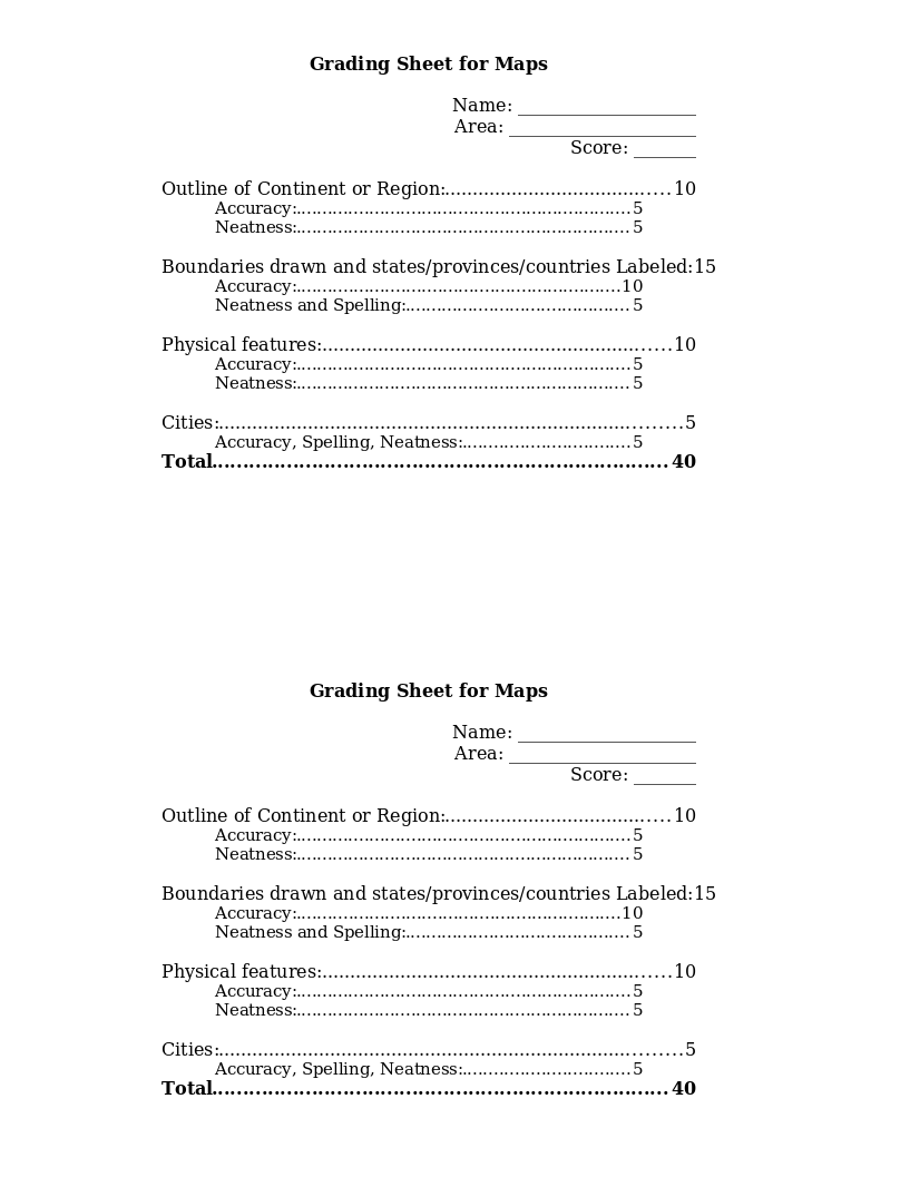
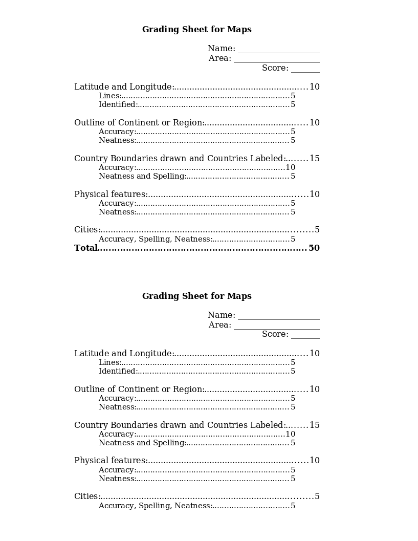
This grading rubric is to be filled out by the teacher to grade each student on part of the final map project. It grades outline of continent, country/state/province boundaries drawn and labeled, physical features, and cities for...
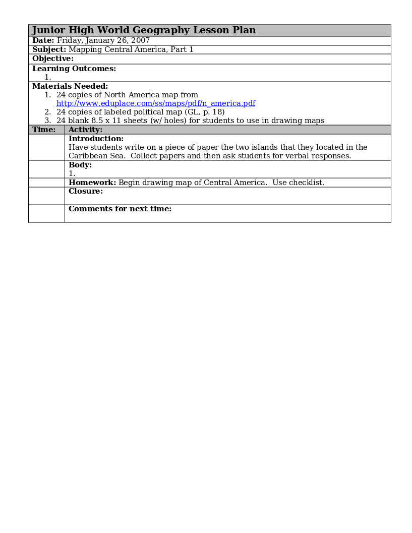
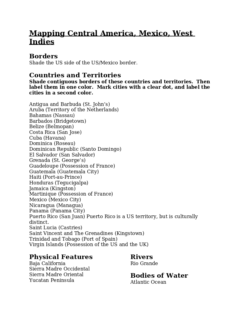
Instructions for drawing and coloring a map of Central America. Includes a list of the countries, territories, cities, physical features, rivers and bodies of water that are to be located on the map.
This grading rubric is to be filled out by the teacher to grade each student on part of the final map project. It grades latitude and longitude, outline of continent, country boundaries drawn and labeled, physical features and...