Planning events can appear daunting, particularly when planning a new event. Understanding aspects common to all events provides an entry point for planning, while using those aspects as an outline for planning ensures that...
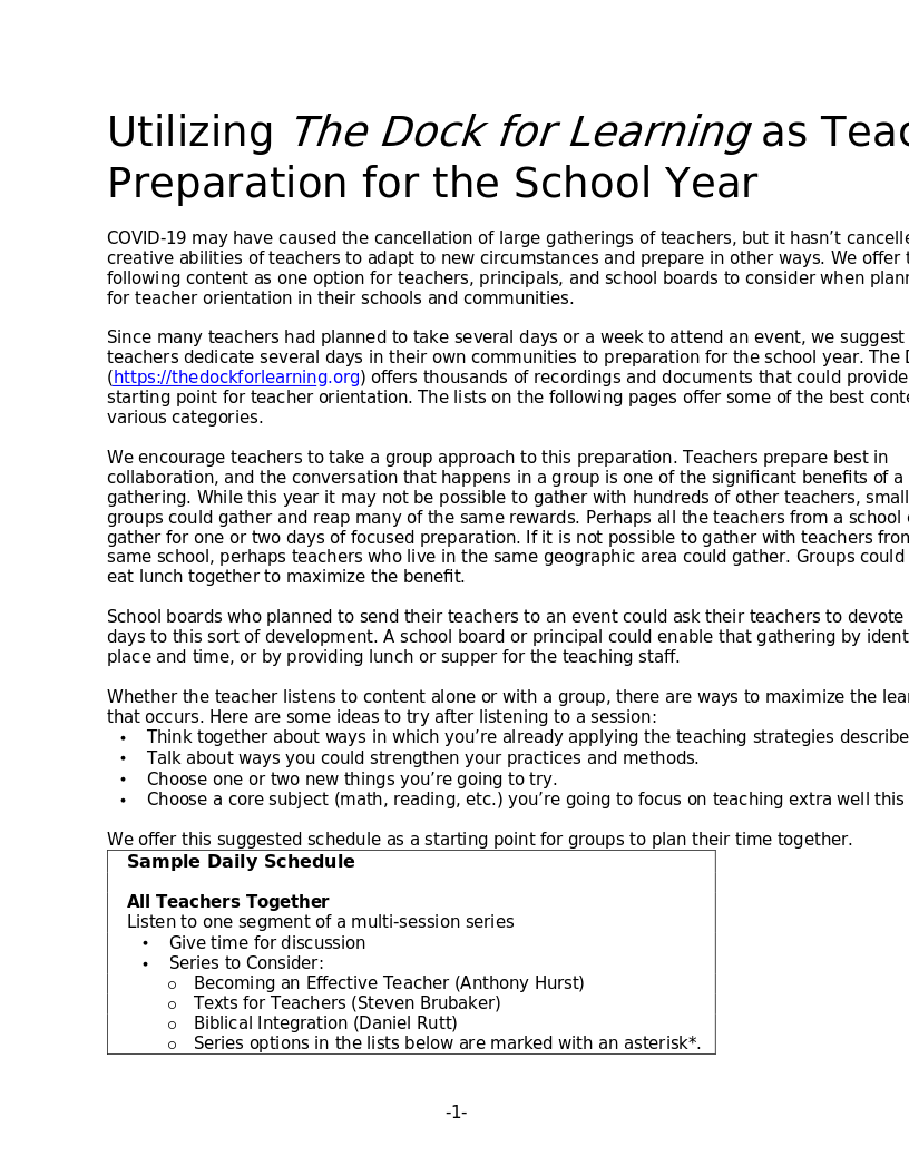
Utilizing The Dock for Learning as Teacher Preparation for the School Year Download as PDF Planning intentional development through The Dock This guide was originally developed as a resource for teachers who could not attend...
Some pictures of student-drawn maps for the final map drawing project in World Geography. Click on an image for the full-size file. Central America South America Europe
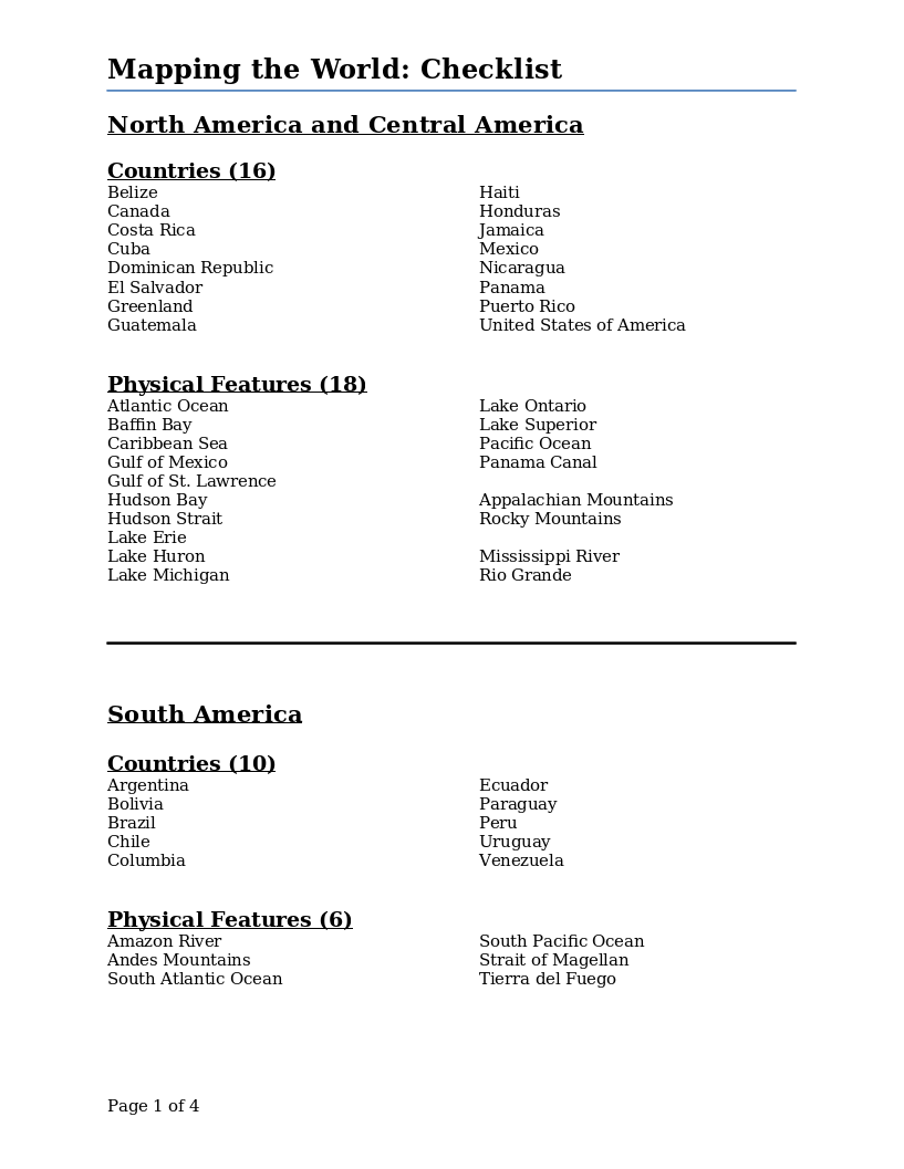
This checklist for the final project of drawing a world map lists the countries and physical features by continent that should be included in the maps drawn by each student.
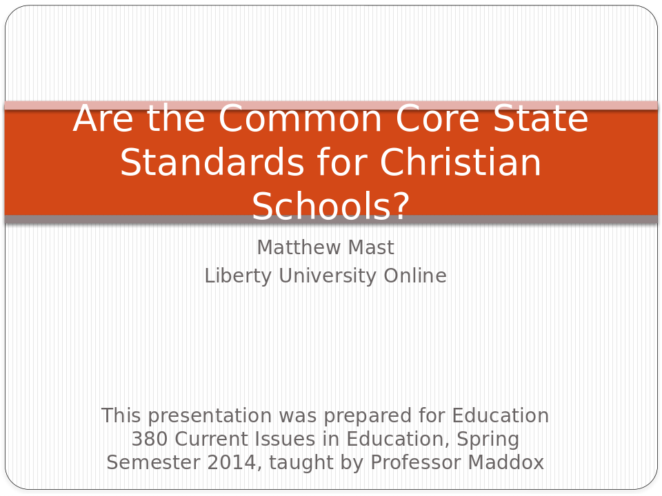
Are The Common Core State Standards for Christian Schools?
A college-level research project on PowerPoint. Matthew Mast begins with defining the Common Core State Standards, telling why and how they were set. He lists pros and cons of using them in our Christian schools. He gives other...
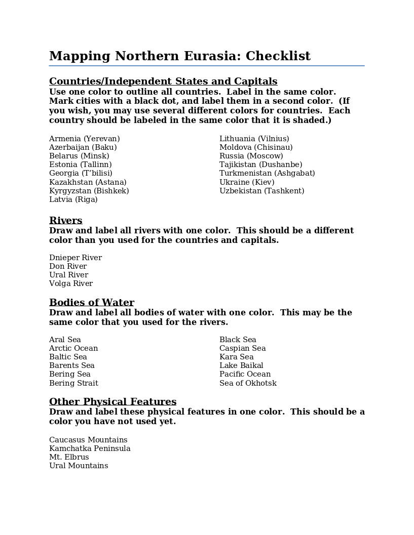
Instructions for drawing and coloring a map of Northern Eurasia. Includes a list of the countries, independent states, capital cities, physical features, rivers and bodies of water that are to be located on the map.
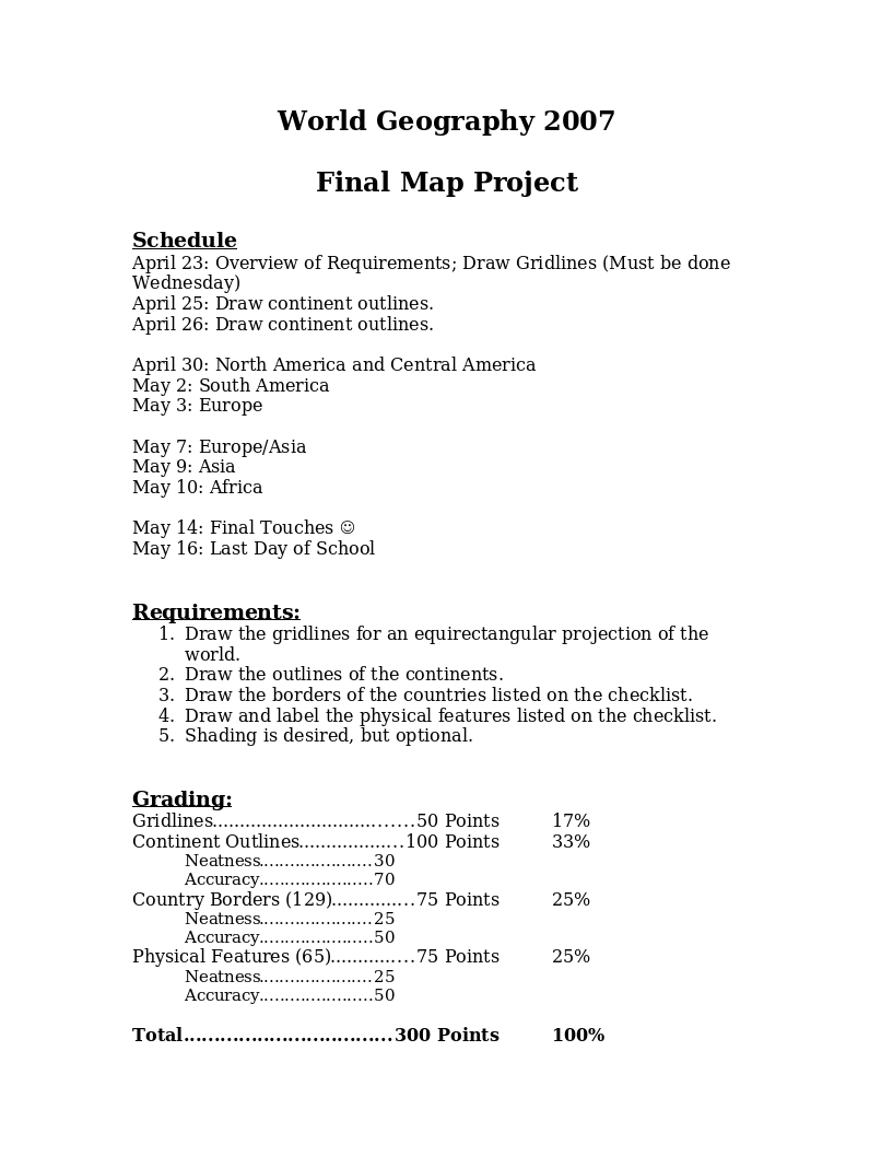
This document about the final map project includes a schedule when each continent map should be completed, requirements for each map, and a grading rubric.
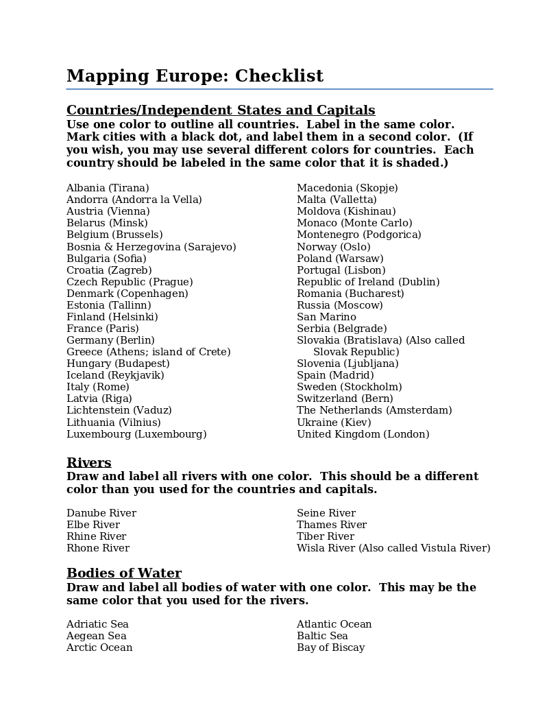
Instructions for drawing and coloring a map of Europe. Includes a list of the countries, independent states, capital cities, physical features, rivers and bodies of water that are to be located on the map.
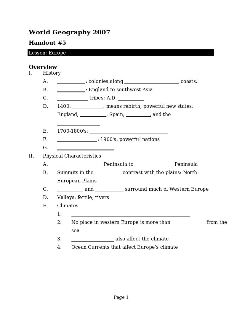
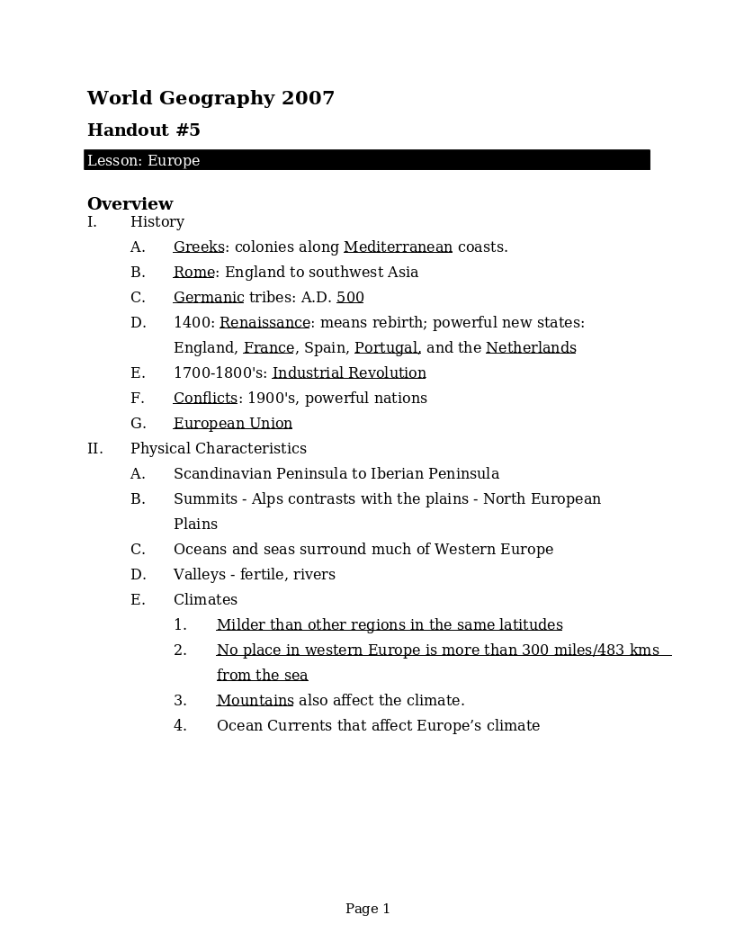
Student handout to go with the lessons on Europe. Includes a brief overview of the history, physical characteristics, people and cultures of Europe. Each country is named with some countries having additional history or physical...
A brief overview of the history, physical characteristics, people and cultures of Europe. Each country is named with some countries having additional history or physical features mentioned.
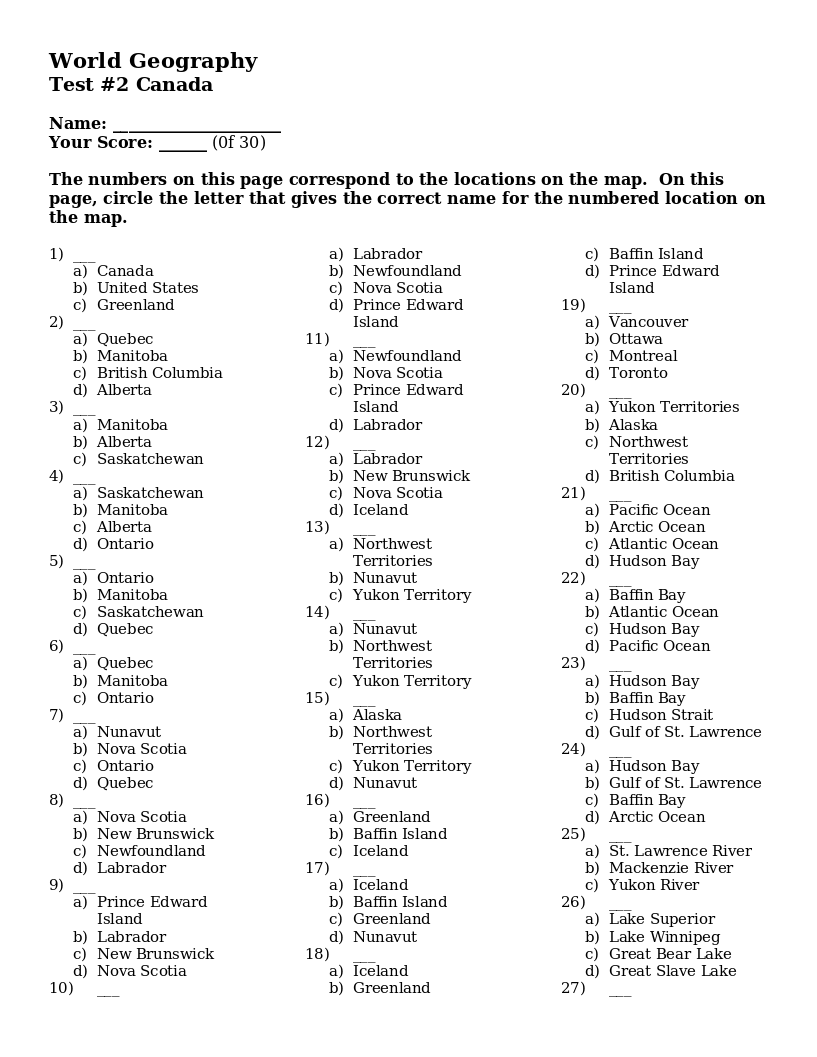
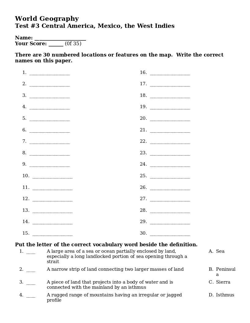
A test on Central America geography. With 30 numbered locations on the map, students are to write the correct names for each location. Includes 5 words to match to their definitions.